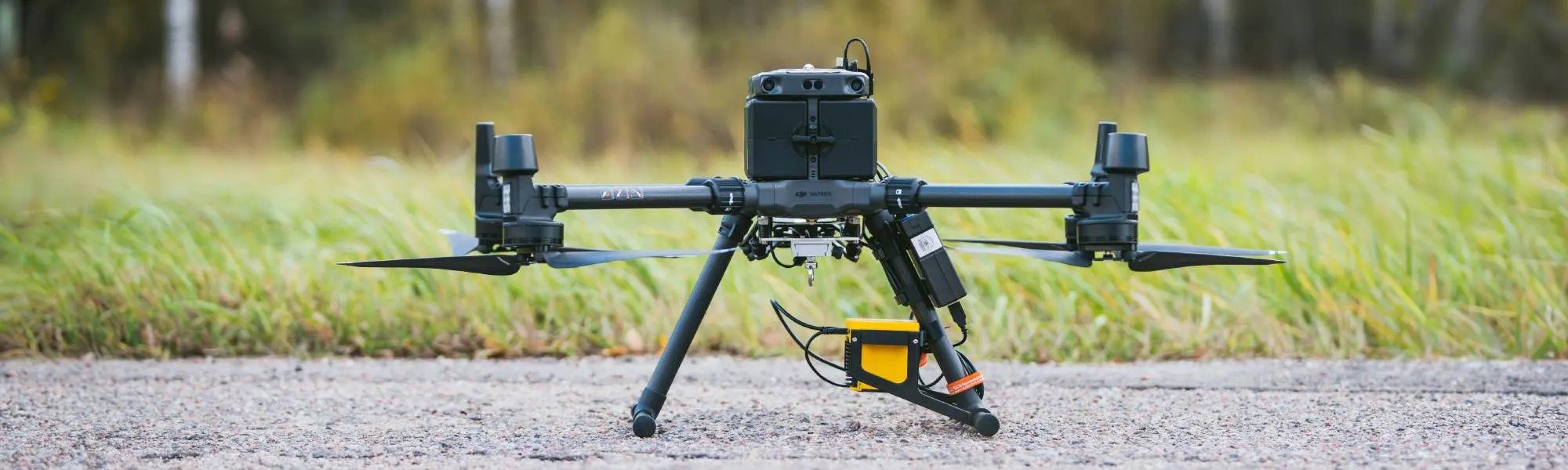
With advanced drone capability and environmental expertise, we provide high-quality aerial data and analysis to help clients manage compliance, monitor site conditions, and drive sustainable, informed decision-making.
UAV Drone Services
-
High-resolution aerial photography and mapping
We capture high-resolution aerial imagery and produce accurate topographic maps using UAV technology, delivering a precise and current visual record of your site. This service is ideal for projects requiring detailed surface data to support planning, design, environmental approvals, and construction oversight.
Applications include:
- Site planning and feasibility assessments
- Environmental and geotechnical reporting
- Construction staging and earthworks tracking
- Development permit and compliance documentation
Deliverables such as orthomosaics, digital elevation models (DEMs), and contour maps are produced efficiently, even across large or inaccessible areas. This drone-based approach reduces the need for traditional ground surveys, improves spatial accuracy, and provides the data necessary for informed, cost-effective decision-making.
-
3D Site Modelling and Volumetric Stockpile Calculations
Using high-resolution drone imagery and photogrammetry, we generate detailed 3D models of project sites to support accurate spatial analysis and volume calculations. These models enable precise measurement of stockpiles, excavation areas, and fill levels—critical for effective materials management, resource estimation, and project planning.
Applications include:
- Stockpile tracking for quarries, landfills, and construction sites
- Cut-and-fill analysis for earthworks and site levelling
- Progress monitoring for bulk movement and site reshaping
- Inventory auditing and material reconciliation
This UAV-based approach reduces the time, cost, and safety risks associated with manual surveys while delivering consistent, repeatable data. It supports faster decision-making, improved reporting accuracy, and greater operational efficiency across resource-intensive projects.
-
Multispectral Analysis for Vegetation and Land Condition Assessments
We provide drone-based multispectral and hyperspectral imaging to assess vegetation health, soil condition, and surface changes across agricultural, environmental, and industrial landscapes. By capturing data in targeted spectral bands—such as near-infrared and red-edge—we can detect early indicators of plant stress, nutrient deficiency, disease, or moisture imbalance before they become visible through standard observation.
Applications include:
- Revegetation and mine site rehabilitation monitoring
- Precision agriculture and irrigation optimisation
- Native vegetation condition assessments for compliance
- Forestry health monitoring and disease detection
- Baseline surveys for sustainability reporting and remediation tracking
These surveys deliver repeatable, spatially accurate outputs to support data-driven land management, regulatory compliance, and long-term environmental performance monitoring.
-
Leak Detection and Infrastructure Inspection
We conduct high-resolution drone inspections of pipelines, roofs, tanks, and other above-ground infrastructure to detect structural defects, damage, and potential failure points—without the need for scaffolding, shutdowns, or confined space entry. Our UAV systems utilise RGB, thermal, and infrared imaging to identify signs of leaks, heat loss, corrosion, insulation degradation, and surface cracking with precision and speed.
Applications include:
- Fuel and chemical storage site assessments
- Industrial plant and processing facility inspections
- Roof and cladding integrity reviews for commercial buildings
- Remote or hazardous asset condition monitoring
- Insurance documentation and compliance reporting
This service reduces risk and downtime while delivering accurate, actionable data to support preventative maintenance, operational planning, and regulatory obligations.
-
Emissions Plume Identification and Hotspot Monitoring
We use advanced UAV-mounted sensors to detect and map gas emissions and thermal anomalies across industrial, agricultural, and environmental sites. This non-invasive service enables the rapid identification of methane leaks, volatile organic compounds (VOCs), and heat irregularities that may indicate subsurface contamination, equipment faults, or elevated combustion risk.
Applications include:
- Surveillance of landfills, composting, and waste treatment facilities
- Leak detection at fuel depots, pipelines, and chemical storage sites
- Monitoring of emissions plumes and heat build-up in processing infrastructure
- Environmental baseline assessments and compliance reporting
By integrating thermal imaging, multispectral data, and gas detection technologies, we provide spatially accurate, high-resolution outputs to support proactive environmental management, regulatory compliance, and operational safety.
-
Infrared and Thermal Heat signature Surveying
Our UAV-mounted thermal cameras provide detailed imaging to support a wide range of applications including energy efficiency audits, asset condition monitoring, and environmental surveys. Thermal imaging allows us to identify areas of heat loss in buildings, overheating components in electrical or mechanical systems, and the presence of wildlife or feral animals—particularly in low-visibility or remote locations.
This service is ideal for:
- Energy audits (e.g. roof and insulation heat loss)
- Electrical and mechanical fault detection in industrial plants and solar farms
- Wildlife detection for pre-clearance surveys, fauna monitoring, and ecological studies
- Surveillance of composting operations and waste facilities for heat buildup or combustion risk
By delivering fast, safe, and non-invasive thermal data from the air, we help clients reduce energy costs, prevent equipment failures, meet environmental compliance, and protect biodiversity.
-
Construction Tracking, Change Detection and Planning Overlays
We provide regular drone-based aerial monitoring to track construction progress and compare real-world site conditions against design plans and project schedules. High-resolution imagery, 3D models, and orthophotos captured at set intervals allow project managers, engineers, and stakeholders to visualise progress, detect deviations, and make informed decisions in real time.
This service supports:
- Verification of earthworks, staging, and structural milestones
- Alignment checks against civil and architectural design drawings
- Visual records for stakeholder updates and contractor accountability
- Dispute resolution and QA documentation
- Improved coordination across large or multi-contractor sites
By providing a consistent, elevated perspective throughout the project lifecycle, our UAV-based monitoring improves transparency, reduces rework, and supports efficient, well-documented project delivery.
-
Safe Inspection of Hard-to-access or High-risk Areas
We conduct safe, remote visual inspections of sites and structures that are difficult, dangerous, or costly to access using traditional methods. Our UAV systems are equipped with high-resolution cameras and specialised sensors to assess rooftops, steep terrain, confined spaces, tall structures, or contaminated areas—without placing personnel at risk.
Applications include:
- Inspections of unstable structures, cliffs, or embankments
- Assessment of fire-damaged, flood-affected, or structurally compromised buildings
- Hazardous material site reviews (e.g. asbestos, chemical spills)
- Monitoring of landslides, erosion, or remote environmental features
- Initial damage assessments following natural disasters or industrial incidents
This service enhances safety, reduces downtime, and ensures that critical assessments can be completed quickly and accurately, even under high-risk or emergency conditions.